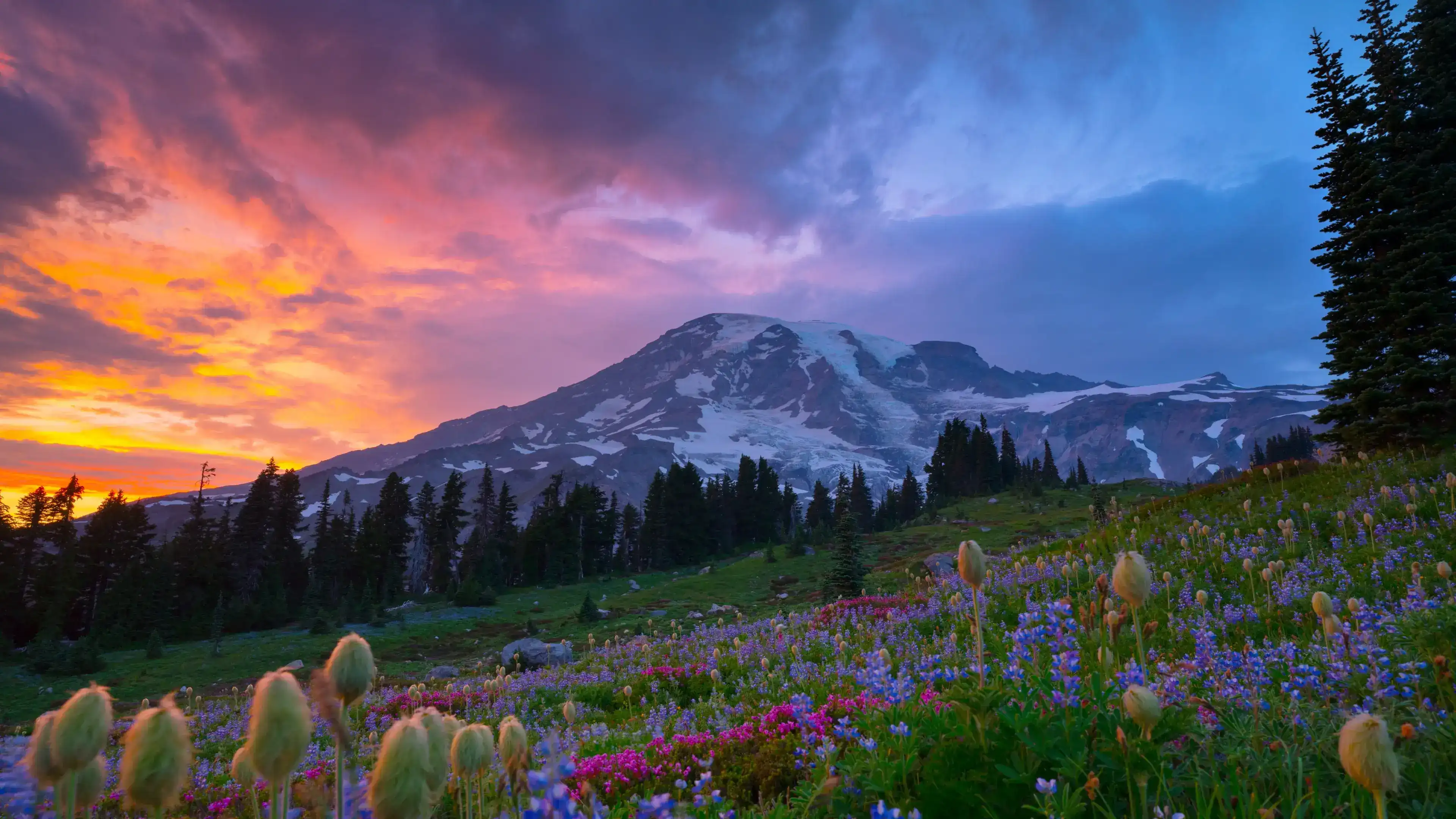
Myrtle Falls, Mount Rainier National Park
A short trail leads to Myrtle Falls, where Edith Creek drops into a rocky gorge with Mount Rainier filling the sky behind it.
- Visit mid July through early August when snowpack has melted, weather is more consistently pleasant, and wildflowers begin to bloom.
- The falls are accessed from the Paradise parking area via the Skyline Trail or Golden Gate Trail, along a paved path that climbs a set of stairs to the viewpoint.
- Myrtle Falls is one of the few places in the park where you can see the mountain and the falls at the same time, so take the short spur trail down to the lower viewpoint for the full frame.
- You may spot marmots, deer, or mountain goats along the way, and early mornings offer the best chances for wildlife.
- The Paradise corridor often requires timed entry reservations during peak season, so check the official park website well in advance to secure your spot.
Myrtle Falls sits about 0.4 miles from the Paradise trailhead, close enough that you can still hear the visitor center behind you when the gorge opens up and Edith Creek drops out of sight below. The falls measure roughly 60 feet, braided as they spill over rock before narrowing through the gorge carved by the creek over many years. What makes this spot unusual is scale: standing at the lower viewpoint, you hold the falls and the full white mass of Mount Rainier in the same frame at the same time, a 14,410-foot stratovolcano rising above subalpine meadow as if the two things belong together.
The sound hits before the view does. Water moving over rock carries up the staircase from the viewpoint, and the air at this elevation runs cool even on clear July days. In peak summer, the meadow surrounding the trail fills with purple lupine, red and magenta Indian paintbrush, white bistort, and Sitka valerian. These are not ornamental plantings — they are subalpine species working through a short growing window between snowmelt and the first fall freeze, typically peaking in late July through early August.
Hoary marmots live in the rocky slopes around the Paradise area and are often spotted near the trail in the mornings, moving low and quick between boulders. The gorge itself is narrow and shadowed, a contrast to the open meadow above it. From the bridge spanning Edith Creek, a short spur trail descends to the lower viewpoint where the geometry of falls, gorge, and glacier-draped volcano align. Take that spur — it's the frame most people come here for.
Getting to Myrtle Falls
The walk to Myrtle Falls covers 0.4 miles from Paradise Inn, heading northeast along the paved Skyline Trail to Edith Creek. Leaving the Paradise Inn parking lot, look for signs toward the Skyline Trail or Golden Gate Trail and Myrtle Falls is 0.4 miles down. The paved asphalt trail starts with a short uphill stretch before climbing a set of stairs to the viewpoint.
A steep stairway descends from the bridge to a superb lower viewpoint of the falls. That lower viewpoint is where the full composition opens up, with Edith Creek, the gorge, and Mount Rainier all in frame at once.
When to go and what light to look for
Mid July through early August is the window when snowpack has cleared, trails are fully accessible, and the subalpine meadow is in bloom. The best weather at Mount Rainier runs mid summer to early fall, with often sunny days and warm temperatures, though conditions can shift quickly at elevation.
These classic locations sit only a half mile from the Paradise parking area on the Skyline Trail and photograph well in morning or evening light, with a preference for sunrise. Be aware that this spot can be crowded not only during the day but during golden hour as well. To avoid crowds, visit either early morning or around sunset, and during the week the falls tend to be less crowded.
Morning is the call here. The mountain faces east and the falls face northwest, so early light catches the upper slopes of Rainier while the gorge stays cool and shaded, which smooths out the water in photos. Arriving around 8:30 on a weekday gives you a reasonable shot at open parking, but the lot fills up by mid morning.
Small details worth looking for
The braided cascade on the rock face. This 60 foot waterfall has a braided cascade, meaning Edith Creek splits across the rock face rather than dropping in a single channel. Watch how the water separates and rejoins depending on flow volume, which changes noticeably from early July through August as snowmelt tapers off.
Hoary marmots near the bridge. There are usually quite a few marmots around the falls, so look for them from the bridge. These are large, ground dwelling rodents with coarse gray and brown fur. They tend to move in the morning, so early arrivals get the best sightings.
Wildflowers along Edith Creek. Some of the best displays of Lewis's monkeyflowers grow near the junction of the Paradise Glacier and Skyline trails, alongside streams thick with bright green mosses. The meadow also fills with lupine, Indian paintbrush, and bistort through late July, all rooted in the thin volcanic soil that Rainier's geology produces.
Insider Tips
Walk past the bridge for the lower viewpoint
Most visitors stop at the bridge over Edith Creek and call it done. The real shot is down the spur trail below the bridge, at the lower viewpoint, where the falls, the gorge, and the upper snowfields of Rainier all line up in the same frame.
The Golden Gate Trail also branches off from this same junction and runs toward Mazama Ridge, trading the Rainier backdrop for views of the Tatoosh Range with wildflower foreground. It sees far fewer people and gives you room to work without a crowd at your shoulder.
Layer up, even in July
Paradise sits above 5,400 feet and the weather shifts fast. Temperatures that feel comfortable at the trailhead can drop noticeably in the gorge near the falls, especially on mornings before the sun clears the ridgeline.
Wear sturdy trail shoes or light hiking boots since the paved path includes stairs and can be slick from mist near the falls. Bring a packable windbreaker and a midlayer you can shed once the sun hits the meadow. A hat doubles as both sun protection and warmth depending on the hour.
Stop at Copper Creek Inn in Ashford on the way in
Ashford sits just two miles from the Nisqually entrance on State Route 706, making it a natural last stop before you enter the park. Copper Creek Inn has been operating on that same stretch of road since 1946, which makes it the longest continuously operating restaurant in Washington state.
Order breakfast before you head up to Paradise or grab a slice of their blackberry pie on the way out. The portions are solid, the menu is made from scratch, and it saves you from paying park-cafeteria prices for a mediocre sandwich.
Nearby Hikes
Trails worth your time when you're in the area.
Skyline Trail Loop
The Skyline Trail is the main loop out of Paradise and covers the full range of what makes this part of the park worth the drive. Starting from the Paradise parking area, the trail climbs through subalpine meadows past Myrtle Falls, up to Glacier Vista, and on to Panorama Point at 6,800 feet where Rainier fills the sky and views extend south to Mount Adams and Mount St. Helens on clear days. The descent passes Sluiskin Falls and the Stevens Van Trump Historic Monument before looping back. Snow can linger on the upper sections into mid July, so check conditions before you go. Budget a full day and bring layers.
View on wta.orgComet Falls via Van Trump Trail
Comet Falls drops roughly 320 feet and ranks among the tallest waterfalls in the park. The trailhead sits on the road to Paradise about four miles below the visitor center, which keeps this one a bit quieter than the trails that leave directly from Paradise. The route follows Van Trump Creek through forest before opening up to the falls. Christine Falls, visible from the road near the parking area, is a natural stop on the way in or out. The trail gains elevation steadily and the final approach involves some rocky terrain, so sturdy footwear matters here.
View on wta.orgNisqually Vista Trail
A fully paved 1.2 mile loop that starts from the lower Paradise parking lot and circles through subalpine meadow to several overlooks above the Nisqually River Valley. The trail gives you clear sightlines to the Nisqually Glacier and Rainier's southwest face without significant climbing. It works well as a warmup before a longer hike or as a standalone option for families with strollers. Wildflowers peak in late July through early August along the same timeline as the rest of the Paradise meadow. Deer and marmots move through the area regularly in the mornings.
View on wta.orgBench and Snow Lakes
This trail starts from a small pullout on Stevens Canyon Road a few miles east of Paradise and reaches two alpine lakes tucked below the Tatoosh Range. Bench Lake sits about a mile in and offers a partial view of Rainier on calm mornings. Snow Lake follows shortly after, set against the rocky slopes below Unicorn Peak. The trail dips and climbs on anti-erosion steps rather than gaining elevation in a straight line, which makes the total gain feel higher than the number suggests. Huckleberries ripen along the trail in late summer. Noticeably less crowded than the Paradise meadow trails.
View on wta.orgNarada Falls via Lower Lakes Trail
This route leaves from the Paradise parking area and follows the Lower Lakes Trail down through forest along the Paradise River, passing smaller cascades before reaching Narada Falls. The falls drop roughly 176 feet in two tiers and are wide enough that the mist carries well off the rock face. Most visitors access Narada from the roadside pullout rather than hiking in from Paradise, so this approach gives you the falls with considerably fewer people around the base. The trail is steep in sections on the return climb back up to Paradise, so save some energy for the finish.
View on wta.orgMount Rainier National Park Hat
100% of the profit from every hat goes straight to the National Parks. Not a round-up. Not a percentage. The whole margin.
Shop this hat
Protecting Mount Rainier
The subalpine meadows surrounding Myrtle Falls sit within a landscape that requires active attention to stay healthy. Humans are a source of disturbance, directly affecting the vegetation in the area. Staying on the trail is essential here because soil compaction can restrict oxygen and water supplies to plant roots, damaging the soil and killing trees.
Meanwhile, broader pressures reach into every corner of the park: changing climate conditions have the potential to alter the park's environment, affecting everything from glaciers and water resources to the distribution and long-term survival of plant and animal species. The waterways of the park are delicate for both plant and animal life, and if water quality drops, routes change, or glaciers melt differently, several native plant species may become threatened.
Over 97% of the park is designated wilderness, and places like Myrtle Falls sit within that protected core. Keeping it intact means the wildflower communities, the creek hydrology, and the wildlife corridors that run through the Paradise corridor remain functional for the people who will come here decades from now. Visitor education and involvement are key to mitigating future threats and protecting the park's natural resources.
That's part of why Rainier Hat Co. exists. We're not just a gear company — we're a funding vehicle for the parks. Every Mount Rainier National Park Hat we sell donates 100% of the profit directly to the National Parks. Buying one isn't a souvenir purchase; it's a direct contribution to the ongoing work of protecting places like this.